This query refers to a building in a large town.
LPT does not apply to this building.
It was formerly a commercial storage unit, and comm rates used to apply to it.
It is currently empty.
The query is about whether the RZLT applies to this building.
Queries submitted to the local authority have got nowhere, they don't want to engage.
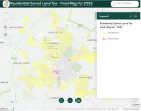
This is the map for Galway:
Taking Tuam as an example, is this what the colours mean:
yellow, residential = no RZLT applies
pink, mixed use = RZLT applies

Thanks.
LPT does not apply to this building.
It was formerly a commercial storage unit, and comm rates used to apply to it.
It is currently empty.
The query is about whether the RZLT applies to this building.
Queries submitted to the local authority have got nowhere, they don't want to engage.
This is the map for Galway:
Taking Tuam as an example, is this what the colours mean:
yellow, residential = no RZLT applies
pink, mixed use = RZLT applies

Thanks.